Damaging thunderstorms possible Monday, NWS warns
Published 2:26 pm Monday, June 12, 2023
|
Getting your Trinity Audio player ready...
|
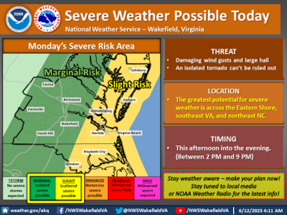
The National Weather Service based in Wakefield issued a hazardous weather outlook alert for the city of Suffolk, as strong to severe thunderstorms may develop Monday afternoon.
A cold front crossing the area this afternoon into this evening may lead to the development of these thunderstorms, NWS said, noting that damaging winds will be the main threat, but large hail is also possible.
The potential for the thunderstorms includes Northampton, Hertford, Gates, Pasquotank, Camden, Western Currituck, Bertie, Chowan, Perquimans, Eastern Currituck, Gloucester, Middlesex, Mathews, Greensville, Sussex, Surry, James City, Southampton, Isle of Wight, Norfolk/Portsmouth, Suffolk, Chesapeake, Virginia Beach, York, Newport News and Hampton/Poquoson, according to the NWS special weather statement.