UPDATE Dorian slows to Category 2
Published 2:39 pm Thursday, September 5, 2019
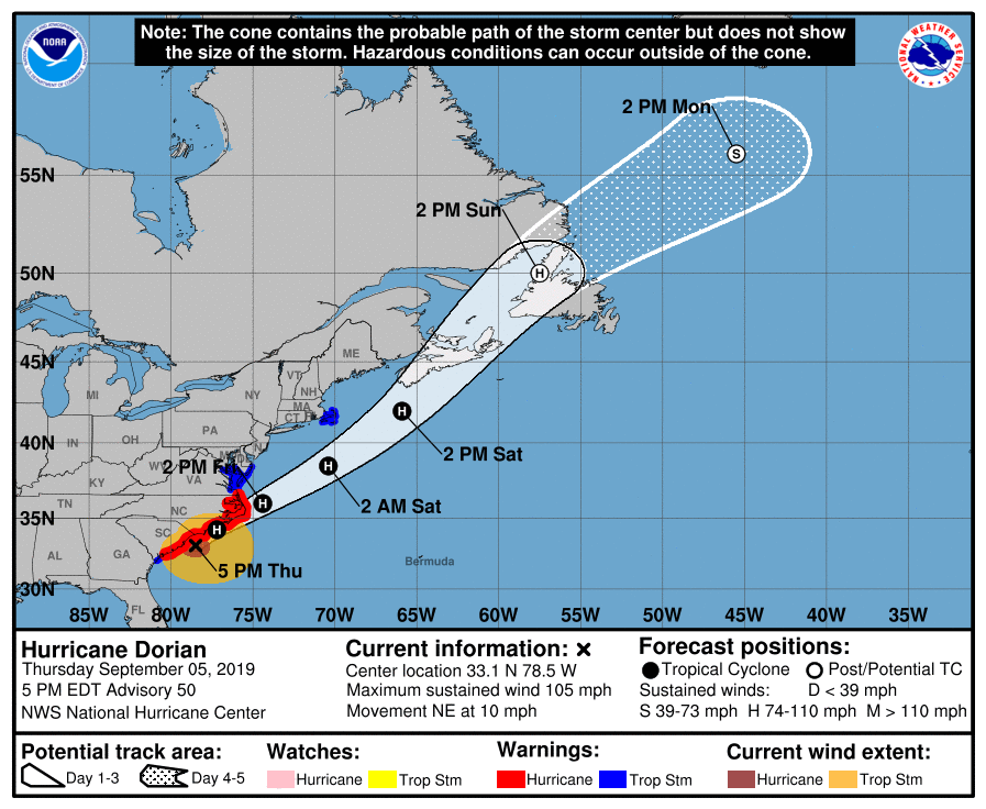
- Much of coastal Virginia, to include the Western Tidewater area, remains under a tropical storm watch. Courtesy | National Hurricane Center
Western Tidewater to feel worst effects Friday morning, afternoon
WAKEFIELD
As of the 5 p.m. update from the National Weather Service, a tropical storm warning remains in effect for all of Western Tidewater until further notice. A storm surge warning is also in effect for northern Isle of Wight County and Smithfield.
A storm surge warning means there is a danger of life-threatening inundation, from rising water moving inland from the coastline, during the next 36 hours in the indicated locations. According to Cody Poche, a meteorologist with the NWS’s Wakefield station, the weather service is expecting two to four feet of inundation around the James River.
Poche added that the NWS is also expecting flash flooding in the city of Franklin, Southampton County and Isle of Wight County. The NWS flash flood watch will take effect at 8 p.m. this evening and continue through 8 p.m. Friday.
“Conditions will start to deteriorate this evening, with the worst happening Friday morning and afternoon,” Poche said on Thursday around 4:30 p.m., but confirmed that as of that time, the Blackwater River was not forecast to go into flood stage.
In terms of rainfall, Poche said Franklin, Southampton and Isle of Wight can expect anywhere from four to six inches. Wind speeds, he said, are forecast to be anywhere from 50 to 60 miles per hour.
“We’ll see the rain move out [of the Western Tidewater area] late Friday afternoon,” Poche said, adding that late Friday afternoon or Friday evening would also be when the wind speeds would start to decrease.
Hurricane Dorian is currently a category 2 storm, producing maximum sustained winds of 105 miles per hour. As of 5 p.m., Dorian was off the coast, near the North Carolina-South Carolina border. Moving to the northeast at 10 miles per hour, it is expected to reach the coast of North Carolina late tonight and into early Friday morning. Hurricane-force winds will extend up to 60 miles from the center of the storm, and tropical storm-force winds could extend as for as 195 miles from the center of the storm.
The NWS now predicts that there is potential for a few tornadoes in the Western Tidewater area.