Hurricane Florence at Category 4
Published 9:12 am Tuesday, September 11, 2018

- Courtesy National Hurricane Center
FRANKLIN
Western Tidewater continues to experience calm, warm and humid weather so far, but as of 8 a.m. at sea (26.4 N 64.6 W,) Hurricane Florence is churning sustained winds of 130 mph. This puts it at Category 4 on the Saffir-Simpson Wind Scale, according to the National Hurricane Center. That’s the low end of the range for that category (130-156.)
The agency states on its website (www.nhc.noaa.gov) that at those speeds even “well-built framed homes could sustain severe damage with loss of most of the roof structure and/or some exterior walls.”
Trees could be snapped or uprooted as well as power poles pushed down, causing power outages that could last for an indeterminate amount of time.
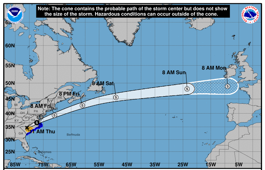
Both a storm surge watch and hurricane watch are in effect for the East Coast from Edisto Beach in South Carolina and north toward the North Carolina and Virginia border, including Pamlico and Albemarle Sounds. The first part means there’s a possibility of life-threatening flooding from the water moving inland to the coastline. The second that a hurricane conditions are possible within the watch area.
On Monday, the National Weather Service’s Wakefield station meteorologist Mike Rusnak stated the hurricane was expected “to make landfall in southeastern North Carolina on Thursday morning, and then kind of slow down, stall and produce a lot of rain.”
That forecast has not changed since. The agency recording states that Thursday will be windy with showers, thunderstorms and highs in the mid-80s. Friday will be very windy with more showers and thunderstorms, then mostly cloudy on Saturday with a chance of showers. Highs remaining in the mid-80s.
Stay tuned for updates from The Tidewater News on the hurricane and related issues.