Franklin City Council debates redistricting map options
Published 12:19 pm Wednesday, April 13, 2022
|
Getting your Trinity Audio player ready...
|
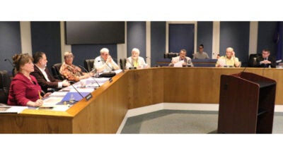
A public hearing on the three redistricting map proposals being considered by Franklin City Council was held during the council’s April 11 meeting, and it featured contentious exchanges between council members and also a member of the public.
Five members of the public spoke during the hearing.
Ward 6 Councilman Robert “Bobby” Cutchins was not present for the meeting.
In a staff report that was part of the board meeting packet, Franklin City Manager Amanda C. Jarratt provided background on the redistricting map proposals.
She noted that every 10 years, after the U.S. Census is conducted, redistricting must occur for
the city’s six existing wards.
“Staff worked with the Hampton Roads Planning District Commission to prepare three options for your consideration,” she stated.
She noted that in preparing the three options, staff was guided by the following requirements for drawing new boundaries:
- The 2020 Census data must be used to determine the number of residents to be included in each district as new boundaries are drawn.
- Boundaries must not be drawn that would deviate from the ideal number of residents in a district by more than 5% or by less than 5%.
- Boundaries must be drawn so as to be compact and contiguous.
- Boundaries must be based on clearly defined and identifiable lines.
- Boundaries should not change the racial demographics of the city.
In the 2020 Census the population losses were in Ward 4 and Ward 5, Jarratt stated in the report. Three options are being presented for consideration.
“It is important to note, that in both Options A and B, the city of Franklin maintains three majority minority districts as is the current scenario under the 2010 final districts,” she stated. “In Option C there are four majority minority districts.”
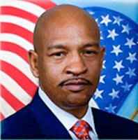
Gregory McLemore
At the start of the council’s April 11 meeting, Mayor Frank M. Rabil asked if there were any amendments to the meeting’s agenda.
Ward 3 Councilman Gregory McLemore said, “Yes, I would like to amend the agenda to potentially have our vote tonight on the maps after our public hearing.”
Rabil replied, “I think that’s out of order because we’ve already advertised two public hearings at your request, so we will not do that. It’s out of order.”
The second public hearing has been set for Monday, April 25.
“But there’s a motion on the floor,” McLemore said.

Frank M. Rabil
“I do not have to entertain that motion because it’s out of order,” Rabil said. “We’ll move along. We will have the public hearing tonight.”
McLemore said, “I didn’t say not have a public hearing. I was saying make a motion to amend the agenda so that we could have a vote.”
“Second,” Ward 4 Councilman Dr. Linwood Johnson said.
McLemore said, “There’s a motion and a second.”
“It’s out of order because we’ve already advertised two…” Rabil said, trailing off as McLemore interjected.
“Let the record so reflect there was a motion and a second, and the mayor refused to recognize it,” McLemore said.
Rabil replied, “Please let it reflect that. That’s fine.”
Later in the meeting, when the public hearing began, the first speaker, Barry Cheatham, favored Map B, noting it is very similar to the city’s current districting map, modifying it only slightly. He said Map B flows well and ensures equitable representation across the entire city.
Cheatham said Map C makes zero sense as to its layout and is an example of blatant gerrymandering on its very worst level.
The second speaker was Michael Bradshaw from Ward 2, and he claimed that McLemore said the Franklin population included 5,000 Black citizens and 3,000 White citizens, and that “the Blacks needed to be in control.”
When he accused McLemore of pushing racism, he was cut off by council members, and he went back to his seat.
The third speaker, Henry Porter, asked if someone on council or Jarratt could elaborate in layman’s terms on what is going on with the maps, noting that a lot of people do not understand.
The fourth speaker, Bill Scott, of Ward 2, said he has looked at all three maps and did not quite understand Map C, noting he was unclear why the redistricting was so prevalent in Ward 1.
He underscored his concerns about the decision the council is facing, and he mentioned one of the important variables being property prices in Ward 5.
“We want to make sure that when you vote and how you vote should be in our favor, in the favor of the city itself,” he said.
The fifth and final speaker was Pearlie Banks, of Ward 2.
“I would like to suggest to council that you go to your specific wards, talk to your people,” she said. “Explain to them what redistricting is. Give them an opportunity to say to you what they think. Councilman (Ray) Smith, I would love to know your viewpoint. I am in your ward. I would like to hear what you say, not only about redistricting but other things that’s going on in the city.”
The public hearing was closed and McLemore led off comments by council members.
Responding to Bradshaw, he said, “I did not say that Blacks would have control from the dias. I don’t think I said (it); if I did, it’s on the tape.”
He also responded to the comments from Cheatham about Map C being a blatant example of gerrymandering.
McLemore noted that the purpose of redistricting is to ensure that the population has accurate representation.
“We were introduced to two maps that, in my opinion, were gerrymandered, because neither of those maps, A or B, represented the population, which as a citizen mentioned, the population according to our records is 5,000 African Americans in Franklin and 3,000 non-African Americans,” he said. “That’s what I said — I didn’t say Whites.
“So with 5,000 African Americans and 3,000 non-African Americans, it would seem that the maps would have been drawn to reflect that, being four seats going to the 5,000 represented and the two or three seats available for the 3,000,” he continued. “So you can put it by color, but if you want to go by color, it’s that, as is, the minority controls the majority.”
He said that he asked for a third map because he said neither A or B matched the population. He said the majority should have the majority representation.
“And that’s all that this has been about,” he said.
He said his seat would not have been affected at all by Map A or B, while Map C will impact it, but he said that is not what this issue is about to him.
“It’s about what’s fair and what’s right, and what’s fair and what’s right is the majority of the citizens should have the majority of the representation, and that’s why Map C was created,” he said. “It wasn’t created to give nobody control but to give this council an opportunity to select a map that represents the population of Franklin.”
He said he will be voting for Map C.
Ward 1 Councilman Mark R. Kitchen said, “On any controversial issue, I’m going to talk to at least a hundred people in my ward of all genders, all races. I’m not going to vote according to my heart, I’m going to vote according to my people’s wishes.”
“I agree,” McLemore said.
Ward 5 Councilwoman Wynndolyn H. Copeland said, “I feel I know Ward 5’s wishes, and I feel that they would want me to vote for Map C.”
Johnson said his main concern is what’s right for the citizens of Franklin.
Linwood Johnson
“I work for what’s right for the citizens of Franklin, not what’s wrong,” he said. “I checked with other municipalities, and they had private individuals to draw up their maps, not staff, not anyone that could be controversial, and they drew it up by the numbers. This is what Map C is — drawn up by the numbers. Not by race but by the numbers, and that’s what municipalities are doing, cities are doing, drawing their maps up by the numbers, not by keeping communities together and so forth and so on, but it’s by the numbers, and the numbers don’t lie. The numbers are right.”
He later added, “So whatever changes I have to make to Ward 4, I’m willing to do that for what’s right for the citizens, not for my comfort. And I’ve talked to my citizens in Ward 4, I stay in communication with them.”
He said he will reserve another comment that he will make at the next meeting.
Copeland said, “And am I correct, Option C, just so the people will know, that’s the elimination of Ward 2, is that correct?”
Ward 2 Councilman Ray Smith said, “Takes me out of my district, that’s correct.”
“Like Mr. Porter said, they need to know what’s going on,” Copeland said. “They need to be informed.”
Ray Smith
Smith said, “Whether I run again for office with my age will be determined at a later date, but I’m certainly not going to vote for a map that votes me out of my own district. I don’t think that’s proper, I don’t think it’s correct, and I don’t think that should happen to anyone.
“With the changing of the legislature and how our congressional seats are going to be lined up, that’s probably going to happen to a few people, but I’m certainly not going to vote for a map that takes away from the people that voted for me and takes me out of my ward,” he continued. “As far who votes for who, it’s kind of immaterial because getting people out to vote is more difficult than it sounds anyway. What was our percentage last year of voters to registered voters? It wasn’t near what it should be.”
Those numbers were later provided from the last May election. The percentage of people that voted who were eligible to vote was 12.8% for Ward 1, 16.1% for Ward 2, 8.5% for Ward 3, 13.4% for Ward 4, 4.8% for Ward 5 and 10.5% for Ward 6.
After hearing those numbers, Smith said the city does not have a districting problem.
“We have a problem with people not being concerned about the welfare of their city,” he said, later adding, “You could cut this map into 15 different pieces. If nobody shows up to vote, it doesn’t matter. So I don’t know why we’re arguing about the boundaries of a map.”
For the benefit of the public listening to the meeting, Copeland made a point to reconfirm with Jarratt that Maps A, B and C are all legal, which Jarratt confirmed.