IW Planning suggests eight options for future growth
Published 11:18 am Friday, February 2, 2018
CARRSVILLE
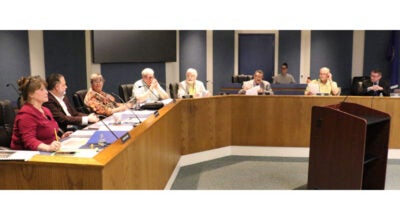
Isle of Wight County’s planning and zoning staff presented Carrsville residents with eight future land use scenarios on Tuesday during a public forum intended to solicit residents’ input on Isle of Wight’s 2018 Comprehensive Plan.

This map prepared by Isle of Wight Planning and Zoning staff illustrates their “small towns and villages” option for the county’s 2018 Comprehensive Plan. If implemented, the boundaries of unincorporated communities such as Carrsville, Walters and Zuni would be expanded and development in those areas would be encouraged. — Submitted | IW County Planning and Zoning
The forum, held in the Carrsville Community Center, was the second in a series titled “Where and How Should We Grow?” According to Amy Ring, the county’s director of planning and zoning, each land use scenario is based on a different goal that a majority of residents advocated during the county’s first round of public forums concerning the Comprehensive Plan held last summer.
The first scenario presented was an agricultural option, where all areas identified as “farmland of statewide importance,” or “prime farmland” are preserved, and areas identified as “prime farmland if drained” are preserved to the highest extent possible, even if they fall within one of the county’s development service districts.
Ring explained that development service districts or DSDs are “growth target areas where the County encourages future growth to occur due to the existing/planned infrastructure improvements in these areas to handle the growth, such as roads, water and sewer.” The county has three such districts: Newport, Windsor and Camptown.
The agricultural option also calls for reducing the number of potential residential units, the square footage of commercial space and the square footage of industrial space in areas of the county slated for potential development, and calls for additional water and sewer infrastructure in rural areas, as well as improvements to rural roads. One downside to this option county staff identified was that there would potentially be fewer jobs and retail or lifestyle amenities available to county residents, as compared with what was predicted in the county’s 2008 Comprehensive Plan.
The second scenario was a DSD alternative option, which called for the creation of core development areas with higher and more intense land uses around major roads, which would taper down in intensity to rural areas further from the core. County staff created this scenario in response to comments from residents made last summer that they did not understand DSDs. Were this scenario to become part of the 2018 Comprehensive Plan, the county would likely see increases in residential housing, students, schools, water and sewer customers (particularly in Windsor and Camptown,) parks and recreation programs and total jobs, but decreases in land preserved for agricultural or environmental/wildlife uses.
The third scenario calls for growth in the central and southern parts of the county, particularly in the Windsor and Camptown DSDs. It would convert future land uses authorized for the Newport DSD to rural/agricultural conservation, save for those that already have approved rezoning, and would reshape the Windsor and Camptown DSDs to increase their development potential.
The fourth scenario was an economic development option to stimulate job creation and grow the county’s tax base. It calls for increasing opportunities for development of all types, and would create an industrial area in the Newport DSD. It would also involve reconfiguring the Windsor DSD and adding major road and water/sewer infrastructure improvements.
The fifth scenario was an environmental-focused option that calls for the protection of wetlands outside the Chesapeake Bay preservation area and includes large areas of possible forested wetlands conservation. It would involve implementing stringent requirements for building on vulnerable lands and the use of environmentally friendly building designs. But again, county staff identified less potential total jobs in the future as a drawback.
The sixth scenario called for containing growth and maximizing land use possibilities within existing DSDs to allow them to remain their current size for the longest time possible.
The seventh scenario called for no growth anywhere in the county, and was the only option that would not accommodate the county’s projected population of just over 45,000 by 2040, according to Ring.
The eighth scenario was a small towns and villages option, which would remove residential and commercial land uses from service districts and incentivize their relocation to the county’s unincorporated communities such as Walters and Zuni. To make this option a reality, Richard Rudnicki, the county’s assistant director of planning and zoning, said that water and sewer lines would need to be extended to these villages, which currently operate on private or communal wells. The downside to this, he said, is that residents may incur a tax increase to cover the cost of the water and sewer infrastructure needed. He added that the county would only need to install the pipelines and that the water itself would come from Suffolk via the Western Tidewater Water Authority.
At the conclusion of the presentation, attendees were given surveys asking them to identify what they liked and disliked about each option. The survey may also be completed online at surveymonkey.com/r/IOWPlan.
Additional presentations of the eight options have been scheduled for Tuesday, Feb. 6, in First Gravel Hill Baptist Church, located at 5230 Old Stage Highway in Smithfield; Thursday, Feb. 8, in the Smithfield Center, 220 N. Church St., Smithfield; and Tuesday, Feb. 13, in the conference room at Sentara St. Luke’s Medical Center, 20209 Sentara Way, Carrollton. All dates include sessions from 3:30 to 5 p.m. and 6:30 to 8 p.m.