Looking back: Two proposals for ‘superhighway’ considered
Published 10:58 am Friday, March 17, 2017
by Clyde Parker
MARCH 17, 1917
There are two different proposals for a “SUPERHIGHWAY” that would be built by connecting and upgrading existing roadways thereby establishing a defined route from Norfolk to Richmond.
PROPOSAL #1, the one that seems to be MOST favored, is the one from Norfolk to Richmond by way of the Norfolk-Portsmouth Ferry to Portsmouth, and then by way of Driver Village, Wilroy, Magnolia, Suffolk, Holland, Carrsville, Franklin, Courtland, Sebrell, Barn Tavern, Littleton, Homeville, Petersburg and, then, on to Richmond. Although Proposal #1, called the “Ridge Route,” is further in distance than Proposal #2, road construction for proposal #1 would be easier and less costly due to the fact that topographical surveys indicate that that route, generally, would pass through more consistently higher elevations; therefore, there would be less need for building up the road-base.
PROPOSAL #2, another route, favored by some and endorsed by the “Norfolk-Richmond National Boulevard Association,” is the one called the “James River Route,” or the “Old Stage Route,” and would run from Norfolk by way of the Norfolk-Portsmouth Ferry to Portsmouth, and then on to Driver Village, Wilroy, Magnolia, Suffolk, Oakland, Chuckatuck, Benns Church, Smithfield, Rushmere, Bacons Castle, Surry, Spring Grove, Cabin Point, Burrowsville, Prince George and Petersburg, and then, of course, from Petersburg to Richmond. Because there is no bridge crossing the Nansemond River, connecting Driver to Chuckatuck, that route would follow an indirect course through Driver, Wilroy and Magnolia to Suffolk and then from Suffolk to Chuckatuck where, from there, it would then follow a more northerly direction.
Logically, at first thought, it would seem that a route going from Norfolk to Richmond by way of proposal #2 would be the most direct — “as the crow flies.” And, seemingly, it would be less costly. Two, it would touch more historic areas and would be parallel to the James River. However, that route would traverse a lot more waterways and hills/valleys than proposal #1, requiring quite a number of additional bridges and/or ferries. There are currently 11 drawbridges. Ferries and drawbridges slowdown motorcar travel and are high-cost factors as well.
Of course, we, in this area, favor Proposal #1, the “Ridge Route,” since it would bring traffic this way, connecting our towns and providing more business for our hotels, cafes, and service stations. It would facilitate commerce. It would provide us with better access to both Norfolk and Richmond.
Getting back to and repeating proposal #1, topographical surveys taken over the past few years indicate that it would be a route that, for the most part, would be at higher elevations with more stable soil conducive to road surfaces of loose gravel and/or clay. There would be less need to build up the road base. The section of proposal #1 that traverses Southampton County, between Courtland and the Sussex County Line, part of the historic Jerusalem Plank Road, is especially suited for the proposed roadway.
On Monday, a booster meeting for the proposed “Ridge Route” highway was held at the Fourth Avenue Armory Hall in Franklin at the call of Mayor J.B. Gay. Resolutions were presented citing the fact that the “Ridge Route” would serve a population of 75,000 whereas the “Old Stage Road,” roughly following the south shore of the James River, would serve only 21,000 people.
However, just yesterday, we, The Tidewater News, learned that a special legislative committee, appointed to recommend routes for proposed Virginia roads to be built with joint State-Federal funds, has recommended that highways be built, BOTH, along the “Ridge Route” and the “Stage Route.” Proponents of the two routes, fearing that only one of them would be accepted, have been lobbying HARD for the road of their choice. Although both routes were chosen, the “Ridge Route” will have a higher priority. The “Stage Route” will be subject to funding.
With the somewhat rapid onset of gasoline-driven and motorized conveyances, and the advantages in developing inter-town connectivity, it is increasingly important for us to have good roads to carry us to that end. General C.C. Vaughan of Franklin is the man who has spearheaded that effort and is the driving force behind our progress so far with highway layout not only in our immediate area but also in other areas of the State.
NOTE: The preceding, as indicated, was occurring in the year 1917. At that time, the present-day U. S. Route 460 did not exist. It was started in 1934 as a two-lane highway, running from Suffolk to Petersburg, paralleling the Norfolk and Western Railway, and connecting, through highway travel, the towns of Windsor, Zuni, Ivor, Wakefield, Waverly and Disputanta. Those towns were already connected by rail and by some meandering roads; but, they were not paved and not directly connected. In the late 1940s, U.S. Route 460, from Suffolk to Petersburg, was widened to four lanes.
Also, in 1917, the present-day State Route 10 did not exist. Some of the roadways, generally along the James River, that existed in 1917 were fragmented, poorly kept and not connected; much later, they were connected to form what we now know as State Route 10.
And, of course, in 1917, the present-day Interstate 64, on the peninsula, did not exist.
That part of the above referenced “Ridge Route” from Courtland to the present-day Interstate 95 is now designated as State Route 35.
Also, it should be noted that Sol W. Rawls Sr. of Franklin served on the State Highway Commission for decades, starting in the early 1920s, and in that capacity, was at the forefront of Virginia highway development.
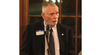
CLYDE PARKER is a retired human resources manager for the former Franklin Equipment Co. and a member of the Southampton County Historical Society. His email address is magnolia101@charter.net


