Flood warning issued for local region
Published 11:45 am Saturday, May 3, 2014
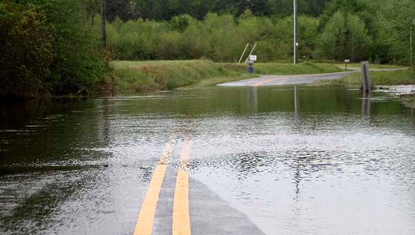
Water floods over Tucker Swamp Road near Ivor. — CAIN MADDEN | TIDEWATER NEWS
FRANKLIN—The National Weather Service in Wakefield has issued a flood warning for the city of Franklin and the counties of Southampton and Isle of Wight.
Eric Seymour, hydrologist for the weather service in Wakefield, said Western Tidewater is looking at a crest of about 11.3 feet, which is about a foot above the flood stage.
“The heavy rainfall that happened this week is what is causing it,” he said. “The accumulated effect of three days of rainfall has pushed the Blackwater up.”
It was projected to reach the flood stage around evening time on Friday, and it is expected to reach its peak sometime this afternoon, before it starts going back down.
“It will have a little bit of impact in the downtown area of Franklin, around Barrett’s Landing. There will be a little bit of water in that area,” Seymour said. “As you are coming down through Isle of Wight and Southampton County, some of the boat landings that people use will be flooded.
“You may have to let it come back down before you launch your boat.
“There are a couple of low-lying roads running along the rivers, between Zuni and Franklin, that will get some high water on it.”
Seymour said to use an alternate route if you come across a flooded road, as it could be deeper than it looks.
He added that it may be sometime on Sunday before all of the effects are cleared.
Chris Turner, who works with the Virginia State Police, was at Barrett’s Landing as the water started to creep above the docks.
“Back when I worked at the mill, we used to sit and watch the water rise,” he said. “Once the 1999 flood came, we all got into a panic whenever the water started to rise.”
A representative of the Franklin Fire Department said that they are monitoring the situation closely and are ready to act.


